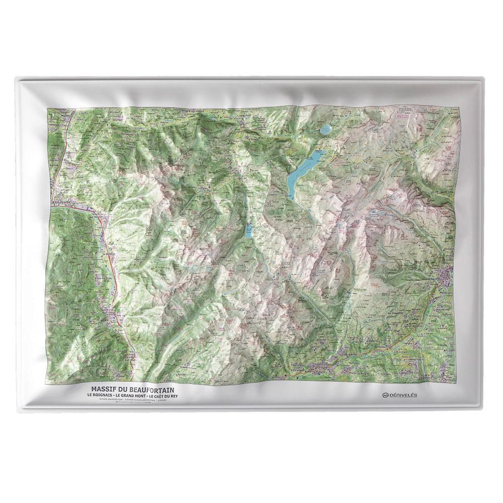
Deniveles - Massif Du Beaufortain - Raised-relief map The Dénivelés du Massif du Beaufortain relief map offers an accurate representation of this region with lots of practical information to help you learn more. GBP 46.67 1
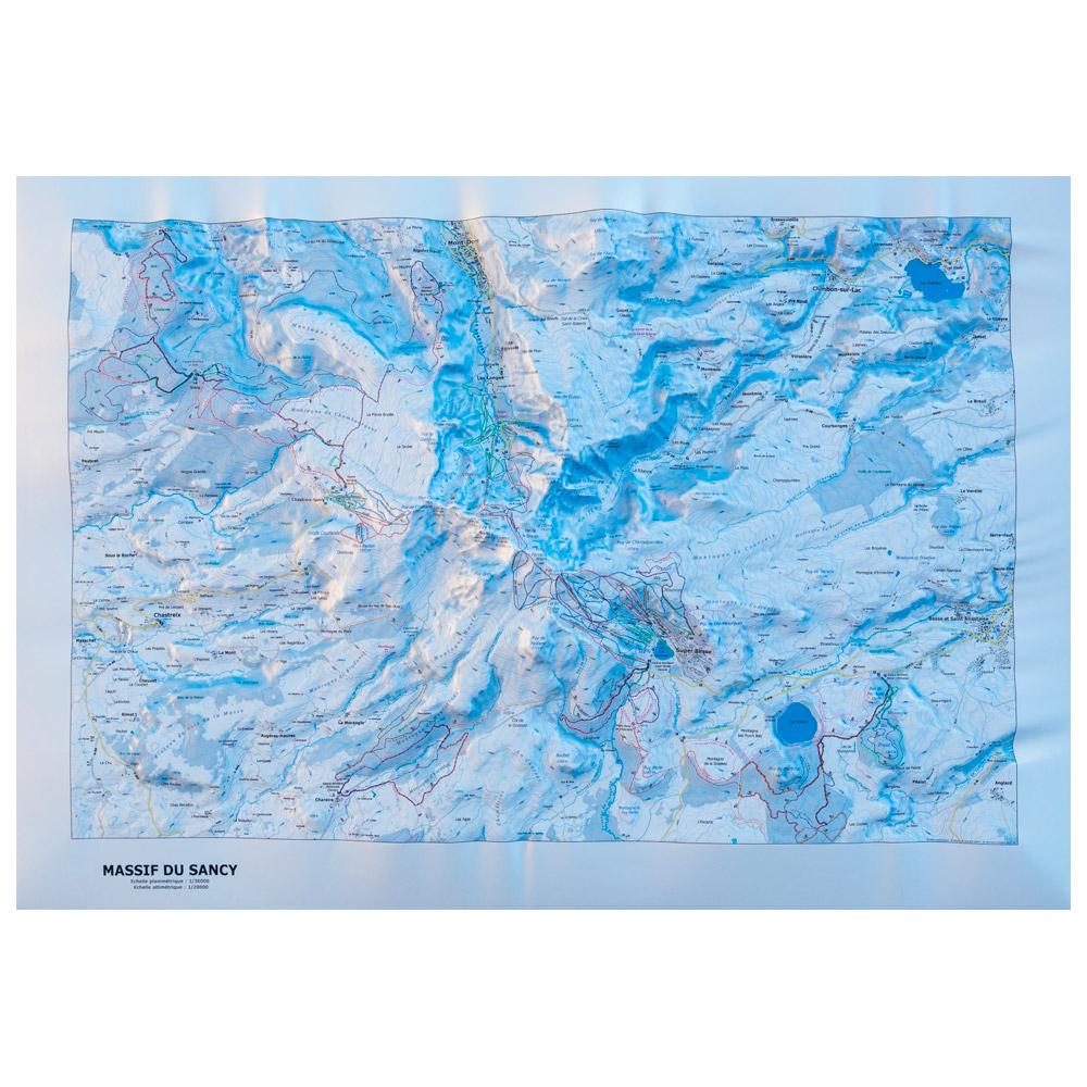
Deniveles - Massif Du Sancy (Winter) - Raised-relief map The Dénivelés Massif Du Sancy Winter is a raised relief map of the Massif du Sancy in winter, made in Auvergne (France), it represents in great details this area at a 1/35000 scale. GBP 48.45 1
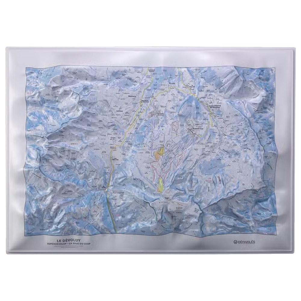
Deniveles - Domaine du Devoluy - Raised-relief map The 3D Domaine du Devoluy map by Deniveles offers a detailed view of the Dévoluy landscape, including peaks, villages and ski resorts, all at a scale of 1:30,000. GBP 46.75 1
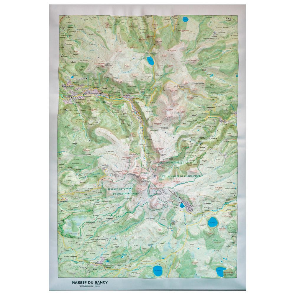
Deniveles - Massif du Sancy (Summer) - Raised-relief map The Dénivelés Massif du Sancy Summer is a raised relief map of the Sancy range in summer, made in Auvergne (France), it shows this area in great details at a 1/35000 scale. GBP 46.75 1
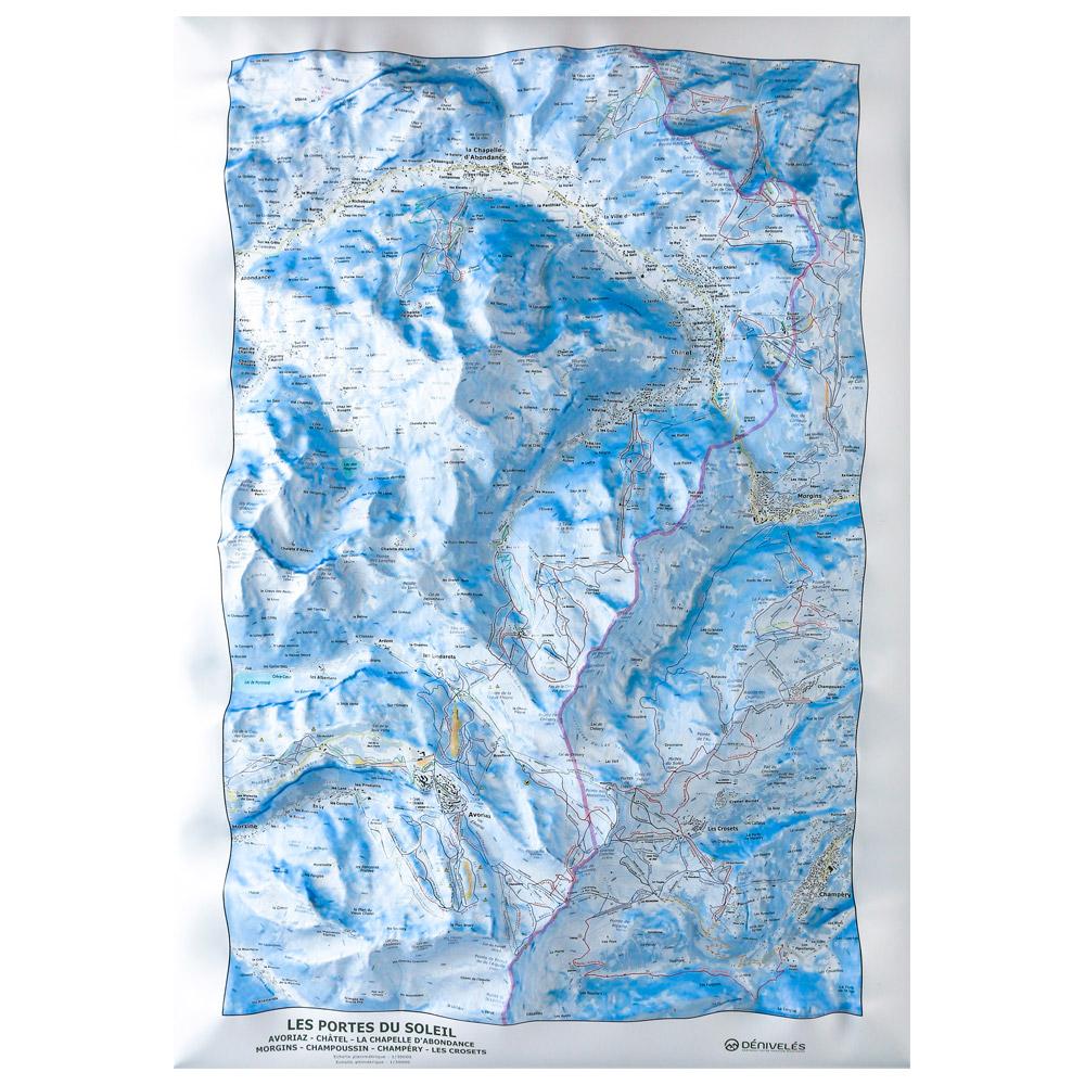
Deniveles - Carte Des Pistes Portes Du Soleil Avoriaz Châtel Chapelle d’Abondance - Raised-relief map The 3D Des Pistes Portes Du Soleil Avoriaz Châtel Chapelle d'Abondance vertical drop map will help you learn all about the region's topography, ski slopes and lifts. GBP 48.45 4
Deniveles - Carte Des Pistes Portes Du Soleil Les Gets – Morzine – Avoriaz - Raised-relief map The Dénivelés Carte Des Pistes Portes Du Soleil Les Gets - Morzine - Avoriaz is a detailed 3D map of the region's ski resorts with their ski runs and lifts. GBP 48.45 4